Grow more per acre.
Predict yield earlier.
Cut chemical inputs.
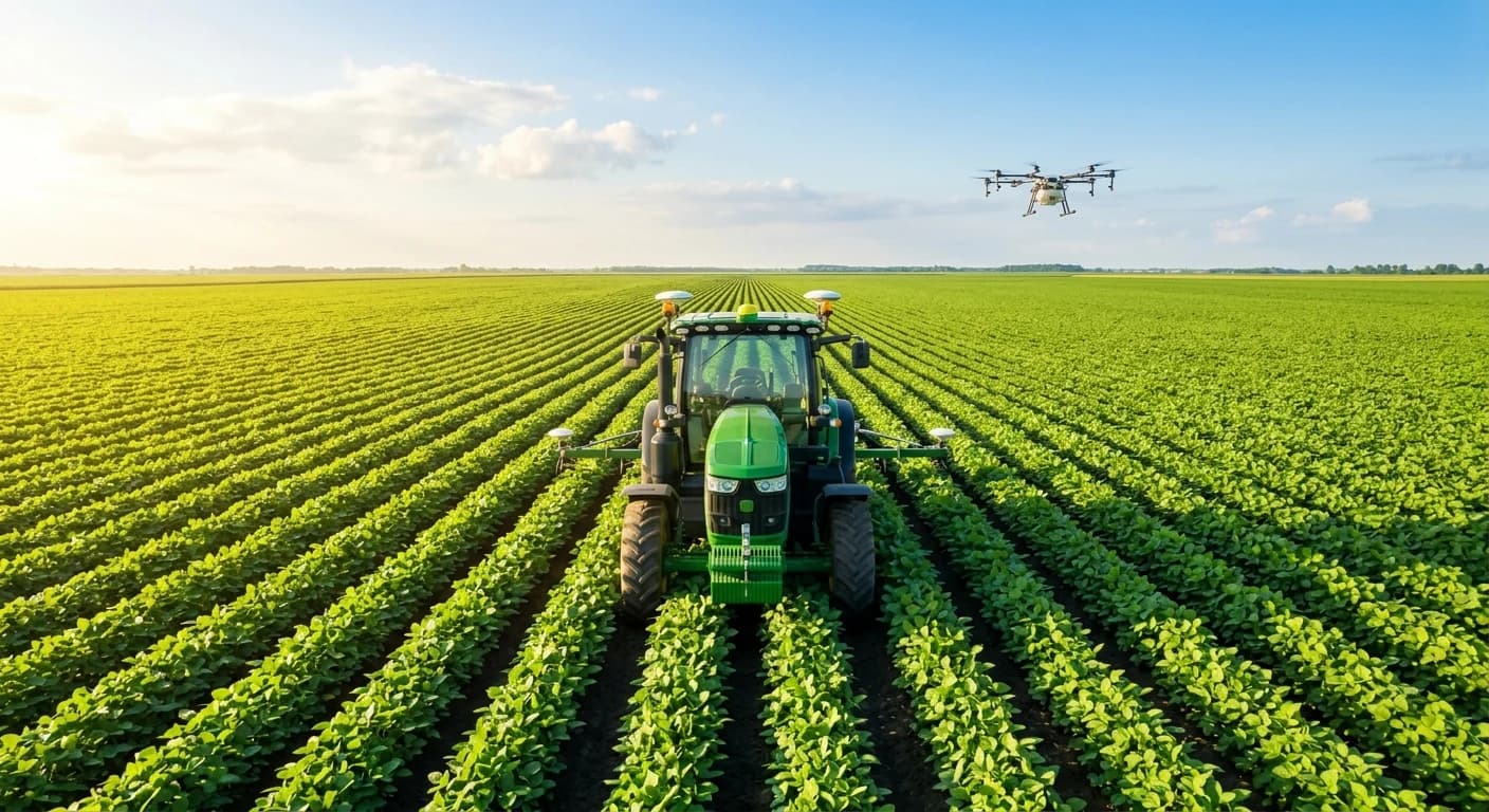
Commercial agriculture demands razor-thin margin precision. From daily satellite NDVI crop health mapping and real-time computer-vision weed spot spraying to predictive evapotranspiration irrigation — Waypoint builds autonomous agricultural AI architectures that maximize farm profitability.
Satellite Sentinel-2 multispectral passes and sub-acre fertilizer prescription zones.
Sub-50ms computer-vision weed classification actuating micro-solenoid valves at 15 mph.
Thermal GDD modeling & ear photogrammetry 30 days prior to combine mobilization.
Evapotranspiration curves coupled with multi-depth root capacitance telemetry.
How the Autonomous Field Works in Real Time
Experience how agricultural AI orchestrates farm operations across disciplines—from satellite NDVI vegetative scouting and computer-vision micro-spraying to pivot hydrology, bushel forecasting, and silo certification.
Multispectral NDVI Vegetative Health Scanning
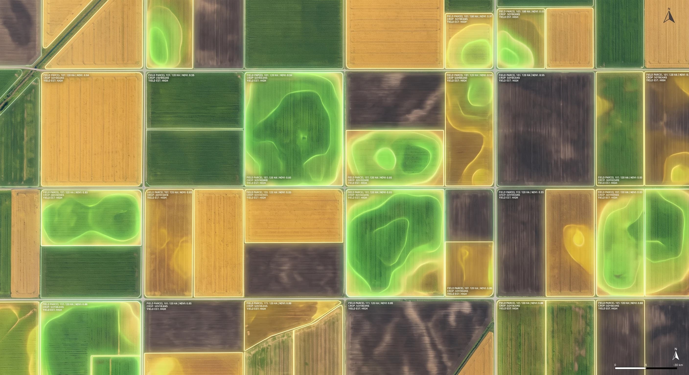
Ingests Sentinel-2 multispectral passes and drone photogrammetry. Runs edge inference to isolate chlorophyll absorption dips and water-stress polygons.
Where Autonomous AI
Transforms Field Performance
Commercial row crop growers and specialty agribusinesses face volatile fertilizer costs, water scarcity, and tight harvest windows. Select an operational discipline to see our bespoke AI solutions:
Precision Agronomy & Satellite Crop Health
Are farm managers relying on manual crop walking across thousands of acres, discovering nutrient deficiencies and water stress too late to salvage seasonal yield targets?
Combine daily Sentinel-2 and Planet multispectral satellite passes with high-resolution drone imagery and IoT soil sensors to generate calibrated NDVI and chlorophyll stress maps with sub-acre prescription zones.
With AI vs. Without AI in Agriculture
Compare how autonomous edge intelligence replaces traditional guesswork, broadacre chemical waste, and manual variance across critical farming sectors.
Benchmark: Herbicide Input & Spray Waste
Entire acreage sprayed uniformly; massive chemical drift and $48K+ annual chemical expense.
4K boom cameras detect weeds at 15 mph, pulsing solenoid micro-valves in sub-50ms over target leaves.
From Pre-Plant Soil Sampling to Elevator Handover —
The Soil-to-Silo Agronomic Value Chain
Explore the 6 production stages of our AI-augmented agricultural delivery model
Pre-Plant Soil Chemistry & Variable-Rate Seeding
Multispectral Drone Scouting & Stand Counts
Targeted Variable-Rate Spraying & Weed Triage
Dynamic Pivot Irrigation & Moisture Hydrology
Harvest Canopy Dry-Down & Real-Time Yield Maps
Grain Bin Aeration & Certified Provenance Turnover
Pre-Plant Soil Chemistry & Variable-Rate Seeding
Analyzes historical yield layers, topography Digital Elevation Models (DEM), and grid soil cores (CEC, pH, organic matter) to prescribe variable-rate seeding densities for every field acre.
Six Always-On AI Sentinels
Across Your Agricultural Enterprise
Engineered with strict ISOBUS compliance, USDA/FDA traceability standards, and agronomist-in-the-loop review boundaries.
Multispectral Crop Health Sentinel
Continuously tracks Sentinel-2 and Planet satellite imagery, computing daily calibrated NDVI, NDRE, and moisture stress indices across all managed parcels to alert agronomists to localized crop stress.
Pest & Weed Computer Vision Scout
Processes 4K boom-mounted cameras in real time at 15 mph to distinguish cash crop seedlings from invasive broadleaf weeds, triggering high-speed micro-solenoid valves for targeted spot spraying.
Precision Irrigation Hydrologist
Ingests hyper-local Doppler radar, root-zone capacitance telemetry (6, 12, 24 in), and atmospheric vapor-pressure deficit to autonomously modulate variable-rate center pivot speeds and drip zones.
Harvest Yield & Readiness Forecaster
Correlates accumulated growing degree days, canopy dry-down trajectories, and drone ear/pod counts to predict field bushels per acre 30 days prior to harvest for optimized grain contract hedging.
Tractor Fleet & ISOBUS Sentinel
Monitors CAN bus engine thermals, hydraulic pressures, and GPS RTK autosteer overlap across tractors, sprayers, and combines to schedule proactive off-shift repairs and eliminate field skips.
Grain Provenance & Traceability Auditor
Synthesizes chemical application logs, seed origin certificates, storage bin aeration moisture readings, and elevator scale tickets to produce tamper-proof non-GMO and organic compliance audits.
Engineered for Broadacre Scale,
ISOBUS Standards, and Edge Resilience
Commercial agriculture cannot tolerate tractor cloud dropouts during narrow planting windows or locked proprietary formats. Our systems adhere to ISO 11783 open standards.
ISOBUS (ISO 11783) & AgGateway Interoperability
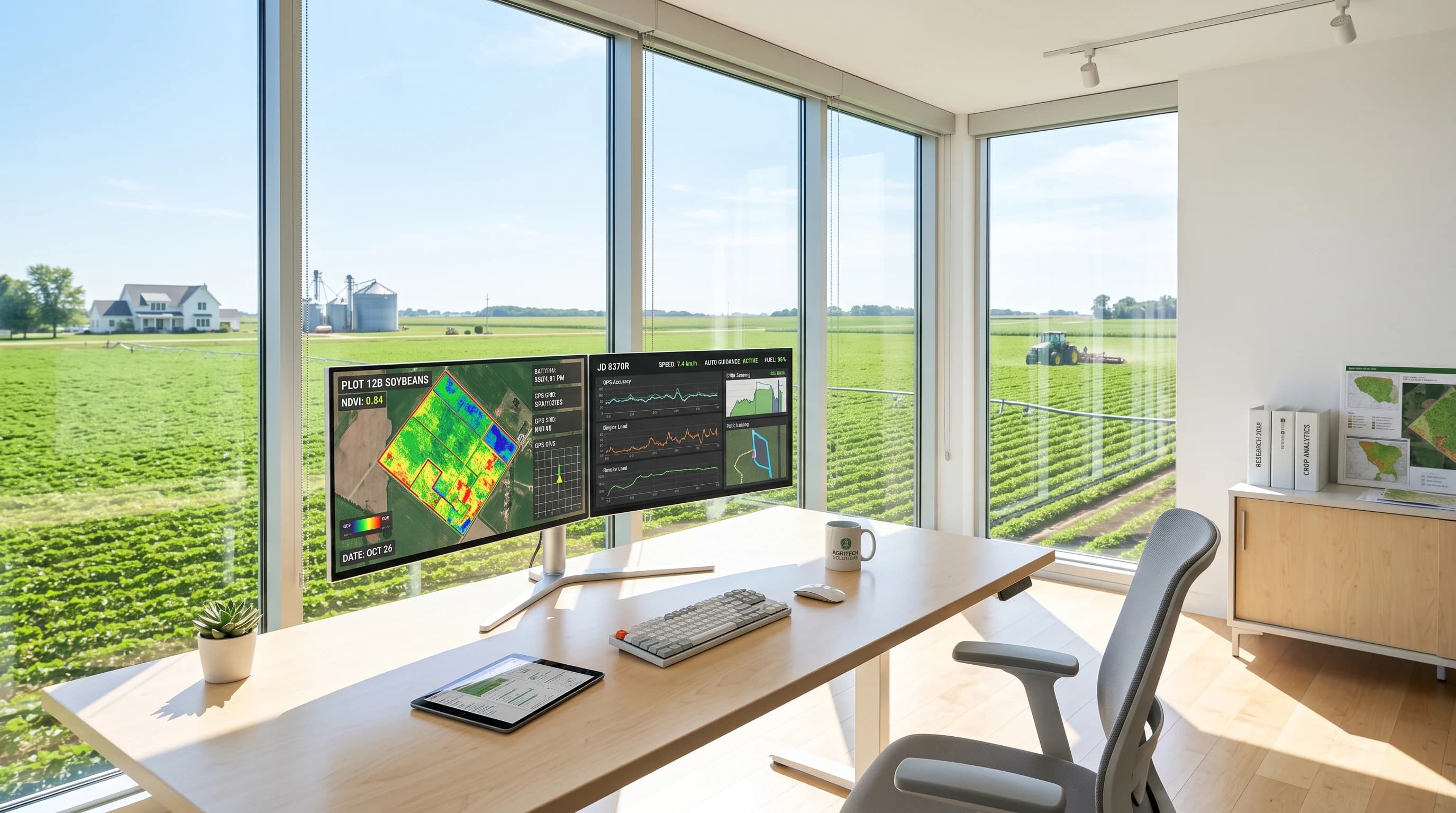
Bi-directional integration with John Deere Operations Center, Climate FieldView, Raven Slingshot, Trimble, and Case IH AFS. Seamlessly ingest machine task files (ISO-XML) with zero proprietary vendor lock-in.
Zero-Signal Local Inference for Remote Fields
Engineered specifically for deep rural farmland lacking reliable cellular coverage. Edge models run locally on ruggedized in-cab displays and tractor Jetson processors, caching data until base station sync.
Grower-First Agronomic Privacy & Compliance
Strict data fencing guarantees that farm yield maps, field boundaries, and financial input costs remain the exclusive intellectual property of the grower, adhering to Ag Data Transparent core principles.
From Acreage Data Ingestion
to Farm-Wide Harvest Rollout
A structured, agronomy-tested deployment pathway validated on broadacre row crops and high-value specialty agriculture.
Field Boundary & Equipment Audit
We review your managed acreage boundaries (shapefiles), historical yield maps, soil survey cores, and connected machinery telemetry (John Deere, Case, Trimble).
High-ROI Intervention Prioritization
We pinpoint where targeted variable-rate nitrogen, automated weed spot-spraying, irrigation optimization, or yield prediction deliver the greatest margin per acre.
Field-Tested Edge & Cloud Architecture
We configure low-latency edge AI runtimes for tractor cabs, smart sprayers, and drone pipelines alongside centralized cloud agronomic modeling.
John Deere, FieldView & ERP Sync
We connect models directly with John Deere Ops Center, Climate FieldView, weather stations, and farm accounting ERPs via secure, authenticated webhooks.
Calibration Across Testbed Acres
We deploy autonomous digital workers across selected benchmark fields, calibrating NDVI stress alerts, variable-rate prescriptions, and computer vision spray accuracy.
Full Farm Parcel Rollout & Yield Telemetry
We scale the verified AI architecture across all commercial acreage with real-time crop health tracking, agronomic dashboards, and harvest profit telemetry.
Field Boundary & Equipment Audit
We review your managed acreage boundaries (shapefiles), historical yield maps, soil survey cores, and connected machinery telemetry (John Deere, Case, Trimble).
High-ROI Intervention Prioritization
We pinpoint where targeted variable-rate nitrogen, automated weed spot-spraying, irrigation optimization, or yield prediction deliver the greatest margin per acre.
Field-Tested Edge & Cloud Architecture
We configure low-latency edge AI runtimes for tractor cabs, smart sprayers, and drone pipelines alongside centralized cloud agronomic modeling.
John Deere, FieldView & ERP Sync
We connect models directly with John Deere Ops Center, Climate FieldView, weather stations, and farm accounting ERPs via secure, authenticated webhooks.
Calibration Across Testbed Acres
We deploy autonomous digital workers across selected benchmark fields, calibrating NDVI stress alerts, variable-rate prescriptions, and computer vision spray accuracy.
Full Farm Parcel Rollout & Yield Telemetry
We scale the verified AI architecture across all commercial acreage with real-time crop health tracking, agronomic dashboards, and harvest profit telemetry.
Frequently asked agriculture & AgTech AI questions.
Direct facts on satellite NDVI imagery processing, ISO 11783 prescription maps, yield forecasting models, and automated weed spray vision.
Our geospatial vision pipelines process Sentinel-2, PlanetScope, and custom drone multispectral rasters, generating calibrated NDVI, NDRE, and canopy nitrogen maps at sub-meter spatial resolutions.
Intelligent farming starts
with precision field telemetry.
From automated satellite NDVI crop stress alerts and computer-vision weed spot spraying to real-time ISOBUS machine telematics — we partner with forward-thinking growers and agribusinesses to protect yields and expand gross margins.